
Large sites rarely fail on one big problem. They fail on volume: millions of scan points, hundreds of small objects, and one terrain surface that has to stay coherent from edge to edge. Project 385.UK, a topographic modeling job in the United Kingdom, was built around exactly that volume.
The brief
The site covered 43,000 m² on a single level. ViBIM was asked to turn a high-density point cloud and existing 2D drawings into a Revit model of the architecture, structure, topography and MEP systems. Architecture and structure were modeled to LOD 300. MEP was developed at LOD 200. The work ran for three months, from June to September 2022.
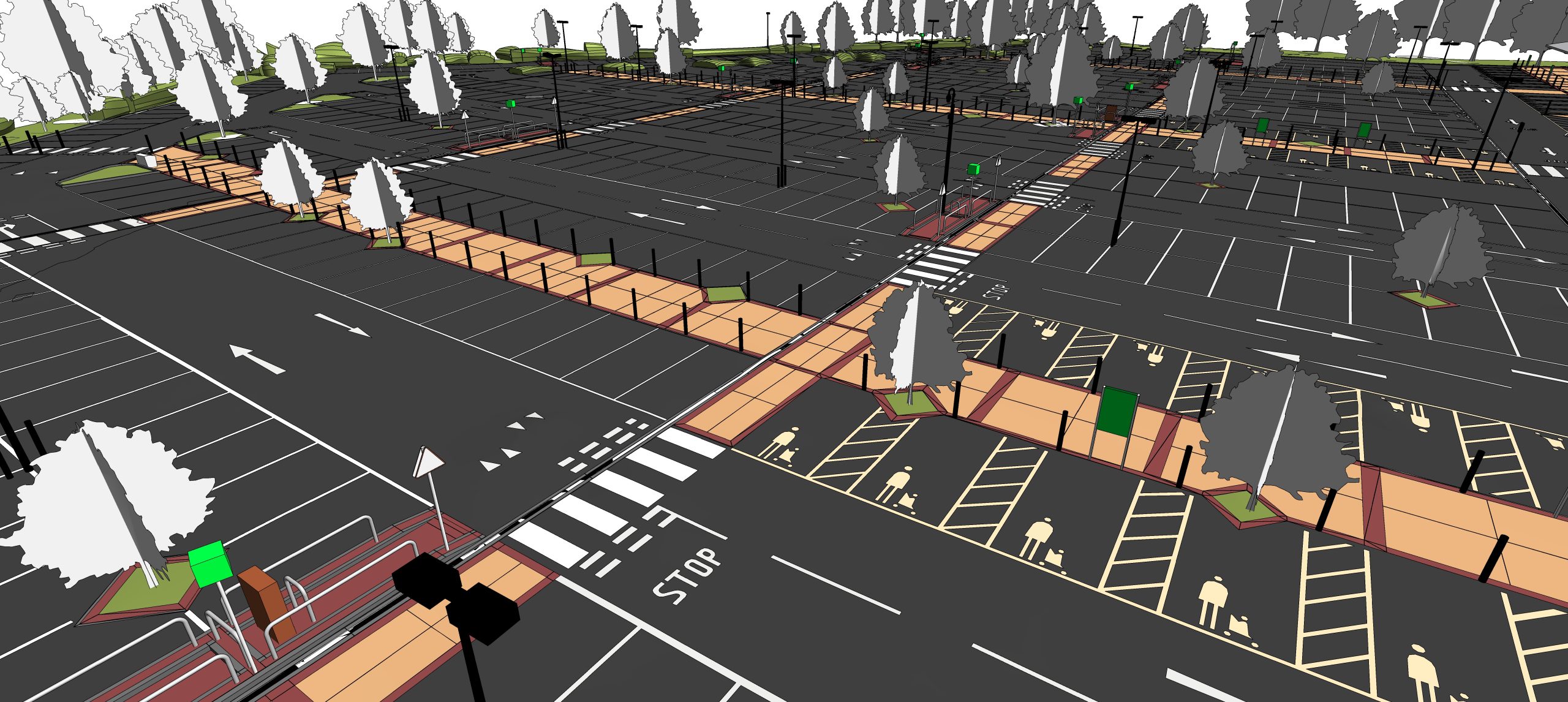
The model had to describe the real site, not an idealized one. That meant roadways, sidewalks, lamp posts, signage, drainage elements and road markings, all placed against the scan data.
What made it demanding
Three things shaped the workflow:
- Dataset size. A site this wide produces a point cloud that can slow a Revit session to a crawl. Model performance had to stay usable for the whole project.
- One continuous terrain. The parking areas and surrounding ground needed to read as a single topographic surface, with no visible seams.
- A long list of custom objects. Each distinct element needed its own Revit family, which adds up quickly across a site this size.
How the team handled it
The terrain was split into smaller independent sections. Each section was modeled on its own, then stitched into one continuous surface. Working in sections kept files light and let several people work without blocking each other.
For the families, ViBIM built an internal tool that loads many families in one batch. That removed a repetitive manual step from the schedule.
Accuracy was checked by comparing the finished model against the source point cloud. The tolerance for the project was ±25 mm, and the deviation analysis confirmed the modeled objects stayed within it.
What the client gets
The deliverable is a Revit file that works as a single source of truth for existing site conditions. Teams planning renovation, repair or asset management start from measured geometry instead of manual survey notes.
Project 385.UK is one of several UK projects in ViBIM's portfolio. If you are comparing how scan data becomes a usable site model, the full project write-up covers the inputs, software and deliverables in detail.
Reference: https://vibimglobal.com/projects/revit-modeling-for-topographical-site-in-the-uk/
See more:
- https://vibim.wordpress.com/2026/10/11/revit-modeling-for-topographical-site-in-the-uk/
- https://vibim-syndication.pages.dev/revit-modeling-for-topographical-site-in-the-uk/
ViBIM
10th Floor, CIT Building, No. 6, Alley 15, Duy Tan Street, Dich Vong Hau Ward, Cau Giay District, Hanoi, Vietnam
(+84) 944.798.298
https://vibimglobal.com/